Cohen & Associates provide a range of surveying services for private, business and government clients.
Click on an image to see a full screen example.
We can also assist with putting clients in touch with other consultants as required.
Property boundary surveys
- Boundary re-marking surveys (i.e. for fencing)
- Forestry GPS surveys to verify title boundaries

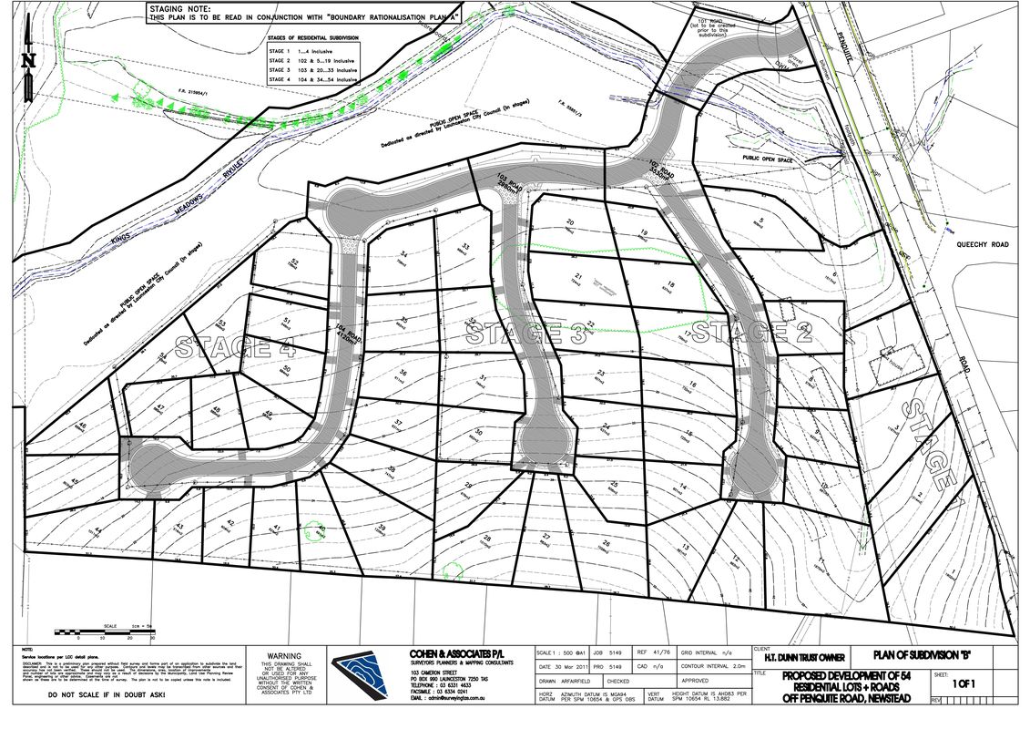
Subdivisions and project management
We can provide various levels of service to suit land subdivision projects all the way to complete project management from start to finish.
- Subdivision design and preparation of all applications as required
- Prepare, issue and manage tender documentation
- Assist by obtaining civil works quotations
- Contract supervision
- Liaison with TasWater
- Referral and provision of instructions to conveyancer or solicitor
- Town planning and development advice
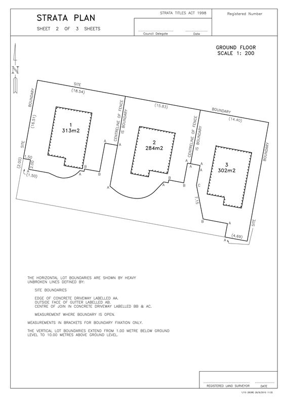
Strata subdivisions
Small two-lot strata surveys, through to complex commercial and residential strata establishment and amendments of existing schemes.
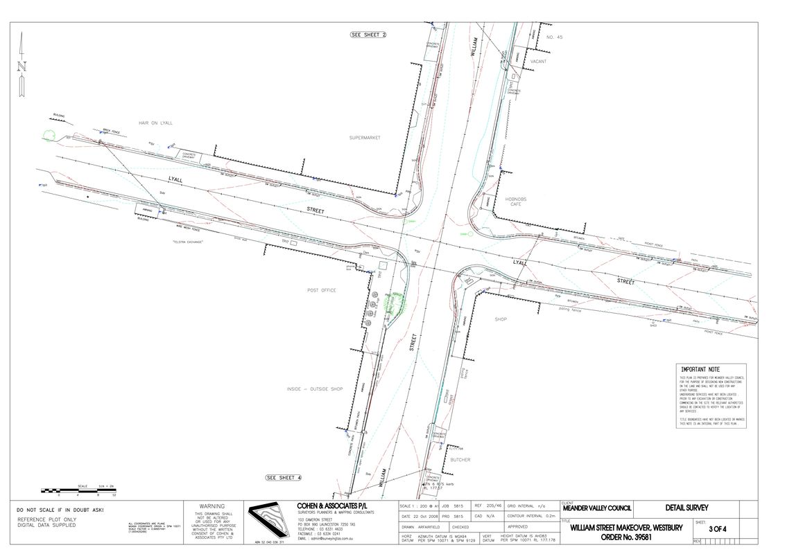
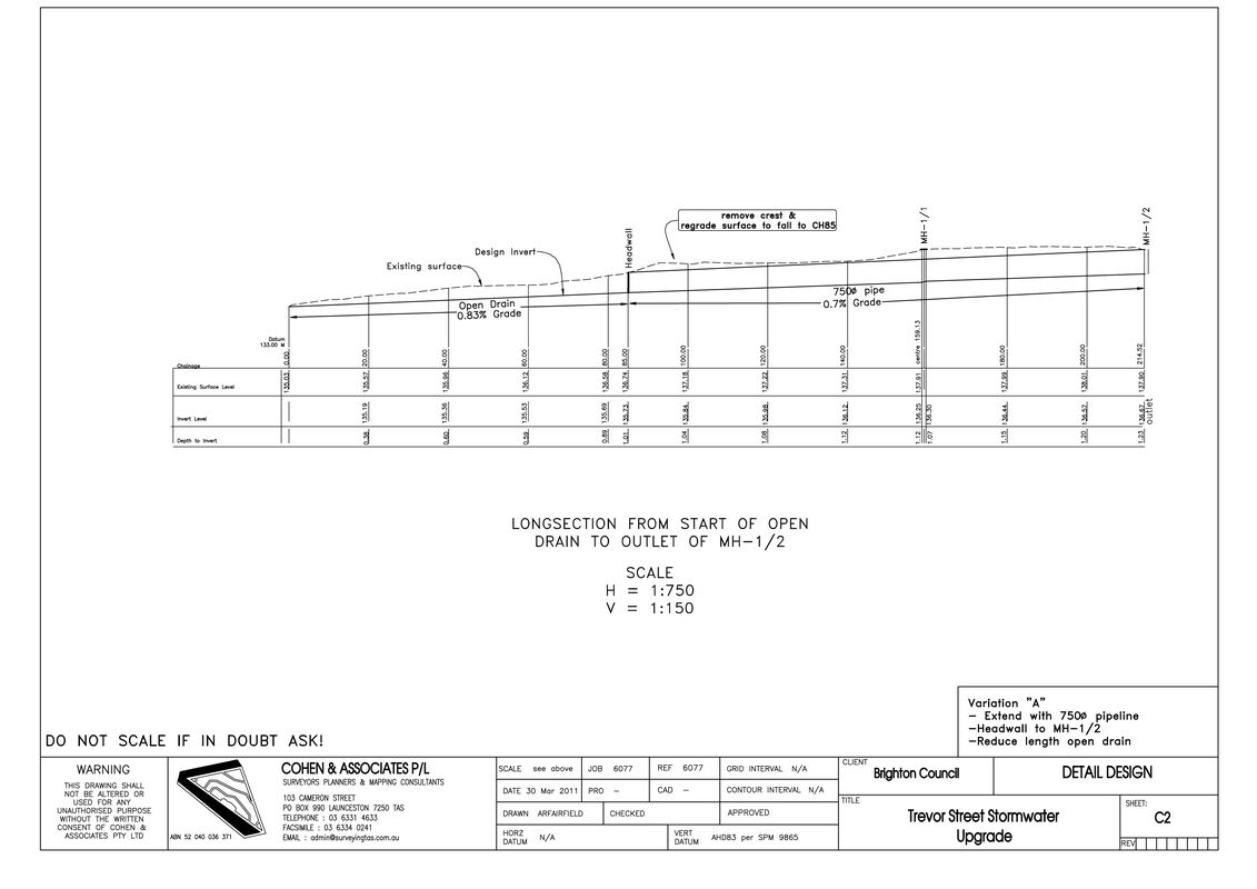
Engineering and construction surveys
- Road detail surveys, cross-section and long-section plots
- Volume calculations
- House and building setout
- Large scale construction setout and control
- As-constructed surveys
- Acquisition surveys
- Pipeline and route surveys
Asset mapping and documentation
Accurate location and documentation of assets and features for projects.
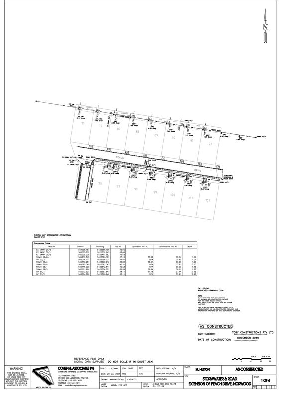
As-constructed surveys
Location and plan preparation showing the as-constructed details in accordance with Council and water corporation requirements.
Identification surveys for new real estate purchases
We inspect the property, take measurements and provide a report and plan, detailing any fencing encroachments, easement or title details you should be aware of prior to settlement.

Detail & contour surveys
- For engineering and architectural design purposes.
- Drainage design for large farming applications.

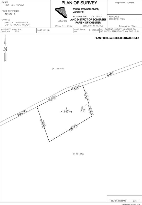
Lease plans and Nett Lettable area surveys
Lease surveys and plan preparation to create a leasehold title registered by the Land Titles Office.
Nett lettable area surveys based on the Method of Measurement for lettable area guidelines prepared by the Property Council of Australia.

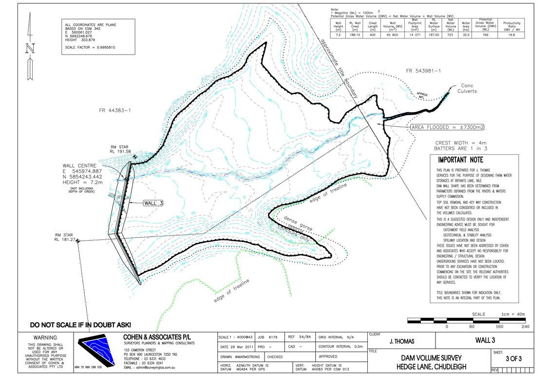
Farm dam surveys
Assist with assessment of on-site water storage options and site selection.
Survey & accurate volume calculations for various dam locations and wall design options.
Including supply of tables and graphs of calculations as required.
We can also assist with referrals to agricultural , geotechnical and engineering consultants as required.


Setout for construction
- Residential and commercial buildings & development
- Roads and subdivision works
- Dams
- Infrastructure works